Tasks and purpose
Tasks and purpose
ultimo aggiornamento: 16 maggio 2015

The “Marmilla and High Marmilla” local action group, named MARMILLA LAG, is a Consortium Company with Limited Liability. Its main objective is “to reinforce the LAG area identity and to intensify its power of attraction as a place to reside, to produce and to tour”, strengthening and upgrading the involvement of the territory actors and the private subjects, ensuring their adequate commitment in the establishment of the partnership and in the formation of the decision-making bodies.
The strategy foresees four specific goals: enhancement of the rural landscape, increase of the entrepreneurial fabric, development of the tourism sector, valorisation of the identity-making capital.
The Company acts in a domain made up of forty-four municipalities of the Region of Sardinia; twenty-seven of them are included in the province of Oristano, the remaining seventeen are located in the province of the Middle Campidano.
Albagiara, Ales, Assolo, Asuni, Baradili, Baressa, Curcuris, Genoni, Gonnoscodina, Gonnosno, Gonnostramatza, Laconi, Masullas, Mogorella, Mogoro, Morgongiori, Nureci, Pau, Pompu, Ruinas, Senis, Simala, Sini, Siris, Usellus, Villa Sant'antonio, Villa Verde, Barumini, Collinas, Furtei, Genuri, Gesturi, Las Plassas, Lunamatrona, Pauli Arbarei, Segariu, Setzu, Siddi, Tuili, Turri, Ussaramanna, Villamar, Villanovaforru, Villanovafranca.
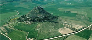
The territory which unites Marmilla and High Marmilla regions has an environmental ring of boundaries of considerable interest from a naturalistic point of view. These borders, from south to west are represented by Saint Miali’s volcanic peaks close to Furtei, the Giara of Gesturi, Mount Grighini, Mount Arci and the Giara of Siddi. It stretches for about 944 square kilometres (Km2). Its resident population is approximately equal to 39.000 units, with a density equal to 41,85 inhab./Kmq2 .
The Marmilla LAG was set up through a public procedure with the participation of the principal local institutional subjects, local companies, trade associations, single citizens. The constitution process come to an end the 9th of July 2009, in Ales, with the subscription of the memorandum of incorporation.
The Gal elaborated a Local Development Plan lasting several years, covering the whole Community programming period, 2007 to 2013. The Plan was approved and financed with € 15.802.649,00 by the Local Government Farming and Agropastoral Reform Department of the Sardinian Region the 7th of July 2010.


