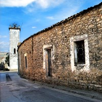
Villanovafranca
Villanovafranca
ultimo aggiornamento: 16 maggio 2015
Sindaco: Daniela Figus (dal 31/05/2010)
Abitanti: 1.441 (statistiche ISTAT 2011)
Posizione: 39°38'44" N - 09°00'8" E
Altitudine s.l.m.: 300 m
Superfice: 27,50 kmq
Codice Istat: 92096
Codice Catastale: L987
Cap: 09020
Patrono: San Lorenzo (10 Agosto)

The municipality of Villanovafranca stands among the landscapes outlined by Marmilla hills.
The territory is rich in Nuraghic period evidence: the most important one is Su Mulinu complex, situated on a height dominating Rio Mannu’s (river) valley. There are an imposing nuragh and a Punic-Roman settlement remains, which prove that the area was consecutively frequented by the second millennium B.C. to the seventh century A.D.. During the first phase, the nuragh had a two-storey structure; later it was covered with earth, on which there was built a bastion with two defending towers linked by some corridors to the lower level.
Tuppedili nuragh, of some archaeological account, is located along the road to Mandas. It has not yet been completely studied until today. The find gave back a big number of grave-goods, going back to the Nuraghic and the Roman periods.
The village, in Risorgimento Square, hosts Su Mulinu Civic Archaeological Museum, which contains and exhibits the finds coming from the homonymous nuraghic complex.
Every third Sunday of May, Villanovafranca celebrates the feast of St. Isidoro’s, farmers’ patron saint, whereby a solemn procession takes place with a parade of agricultural machines decked with flowers and traditional carpets.
Municipality web site: www.comune.villanovafranca.ca.it


